Sveaverken
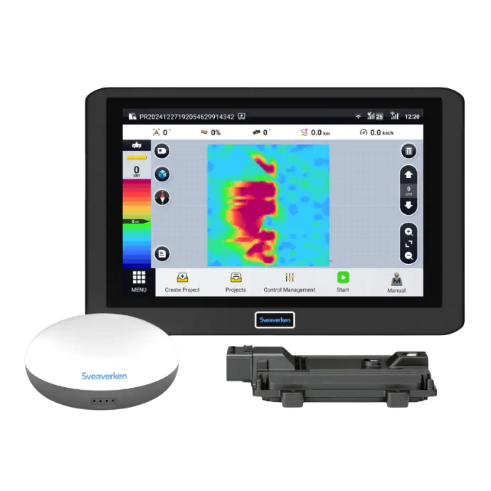
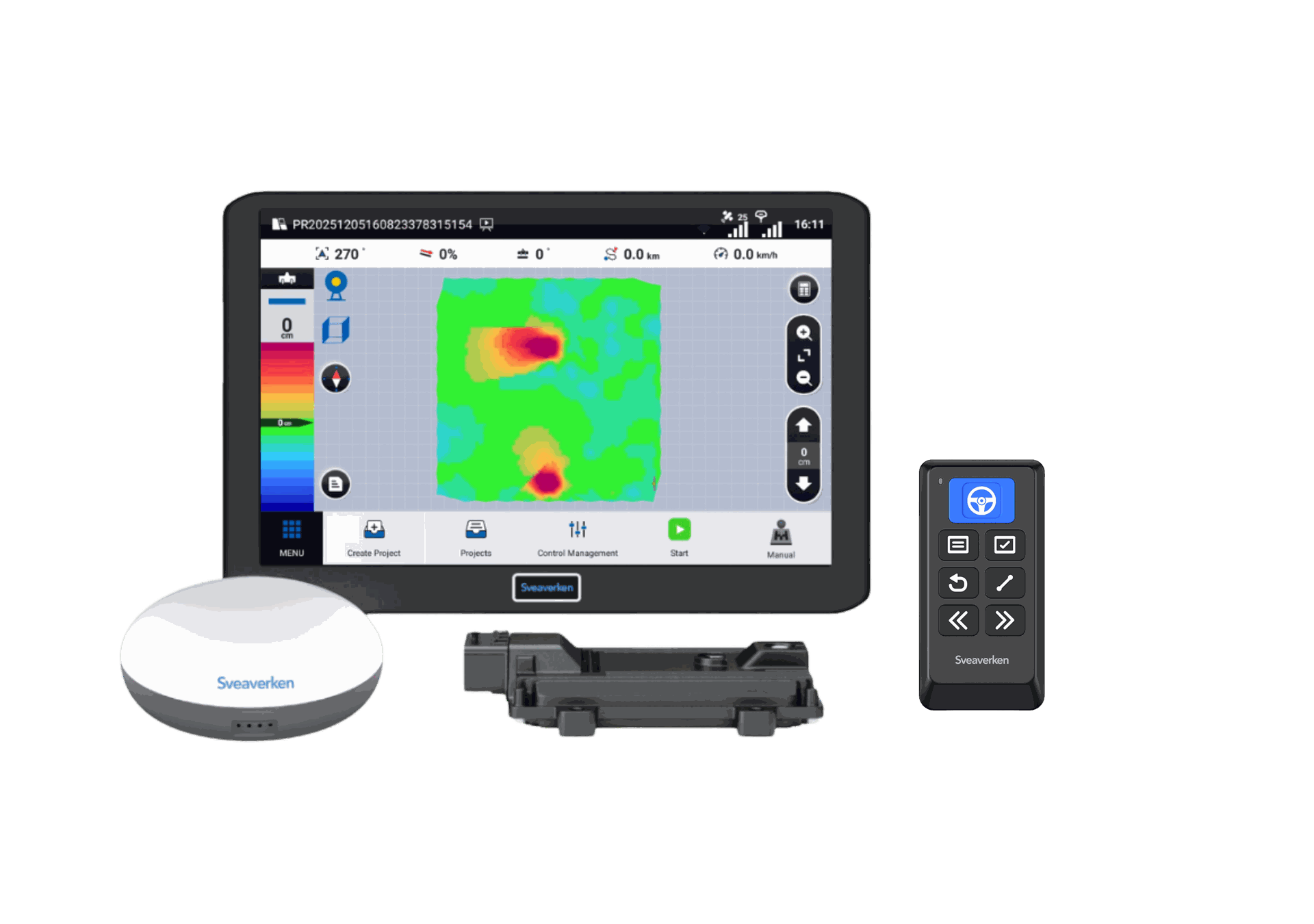
F200L
3D GNSS Land Leveling System
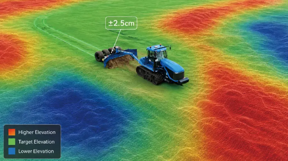
Higher Precision, Less Earthwork
Built with high-precision GNSS positioning and advanced algorithms, the F200L automates blade control for stable, high-accuracy leveling.
It supports terrain surveying and minimal earth-moving designs for both level and sloped surfaces. Engineered for daily farming and professional water management contracting.
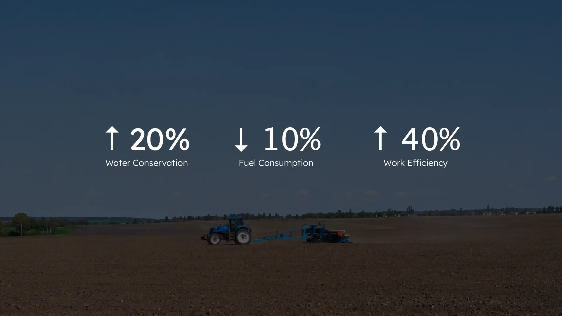
Reliable Control, Proven Savings
Advanced system control minimizes earth-moving volume to create ideal field conditions, directly improving crop growth and survival rates.
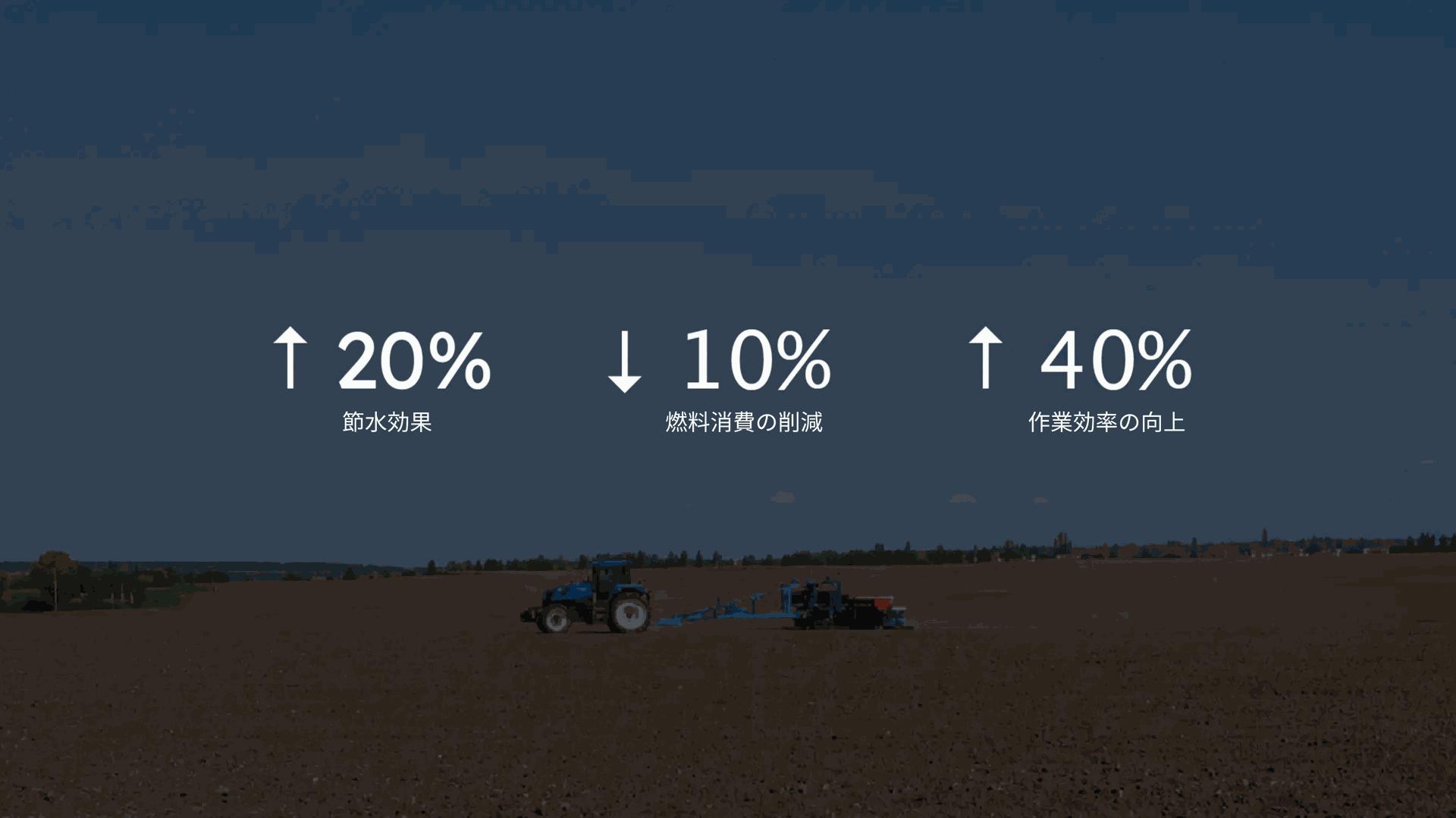
Reliable Control, Proven Savings
Advanced system control minimizes earth-moving volume to create ideal field conditions, directly improving crop growth and survival rates.
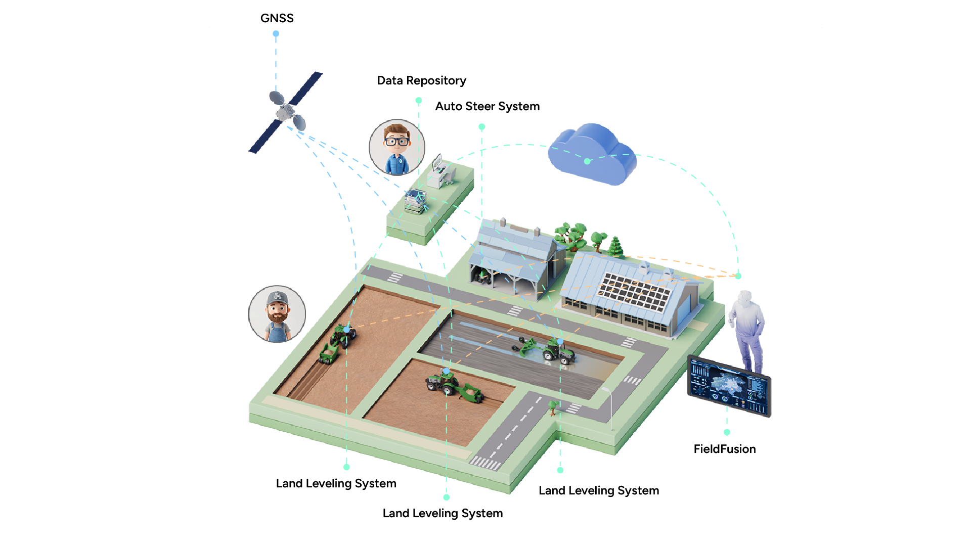
Multi-Terrain Adaptation
Fully compatible with both Dry Land and Paddy Field environments, delivering field-ready versatility for most of land preparation requirements.
Flat Layouts
Single & Dual Slopes
Complex Curved Surfaces

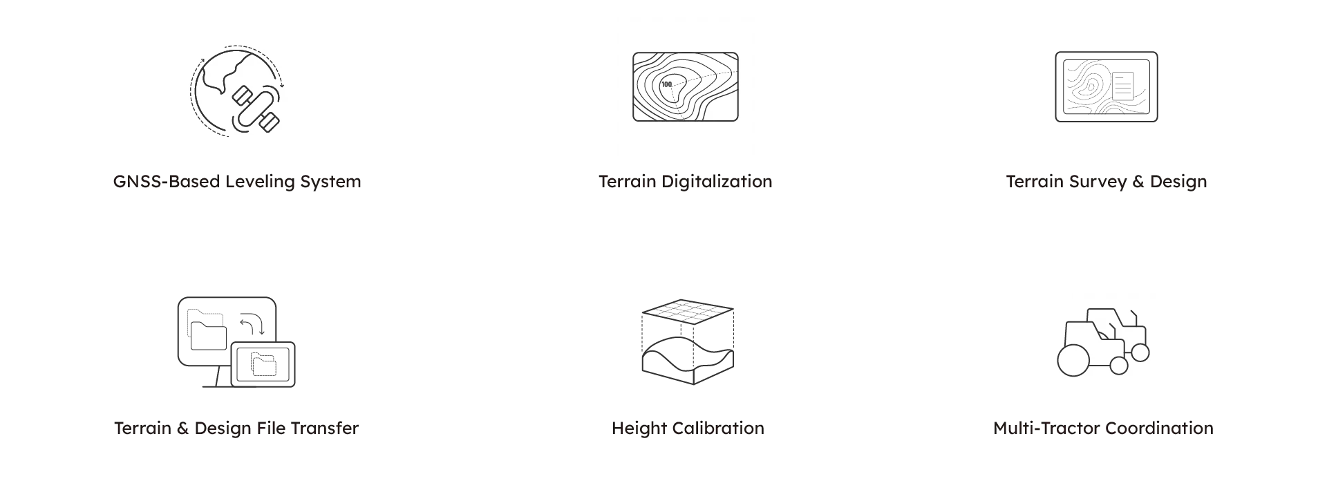
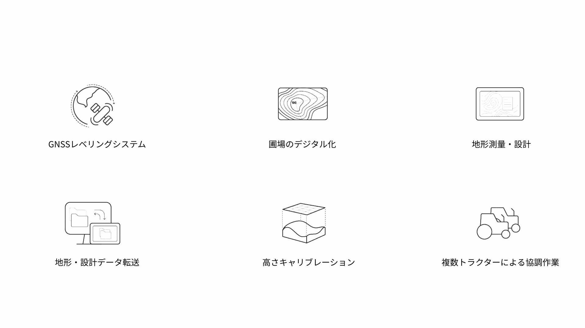
Flexible Surveying & Sharing
F200L
supports terrain surveying, terrain design, terrain file import and export, can automatically generate rendered maps and terrain files, and realizes terrain digitization. Users can also import third-party AGD design files to start leveling immediately and export PDF project reports for record-keeping and management.
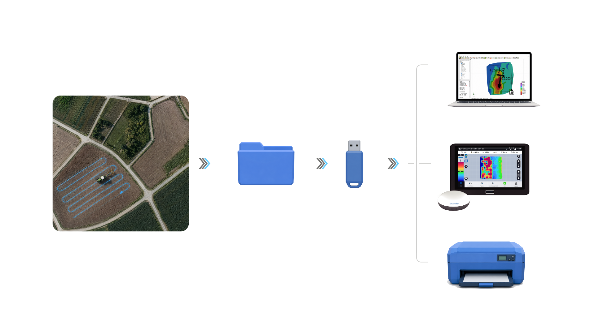
Field-to-Office Connectivity
1. Cloud Upload: 3D survey data from drones or rovers.
2. 3D Design: Via third-party CAD.
3. Wireless Sync: Instant JSON transfer to all
F200L
terminals.
4. Live Monitoring: Real-time fill tracking & PDF reports.
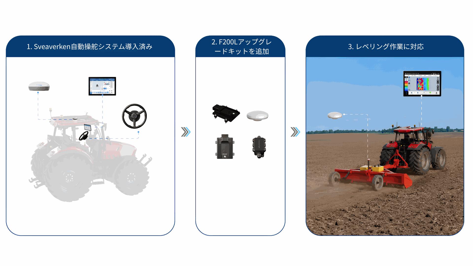
Modular & Extensible Solution
Already own a Sveaverken Auto Steer System?
Simply add the
F200L
Upgrade Kit to unlock professional land leveling at a fraction of the cost.
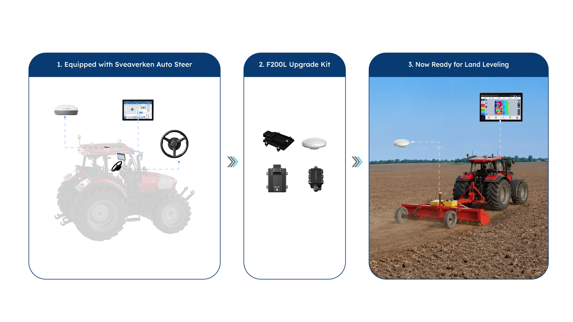
Modular & Extensible Solution
Already own a Sveaverken Auto Steer System?
Simply add the F200L Upgrade Kit to unlock professional land leveling at a fraction of the cost.
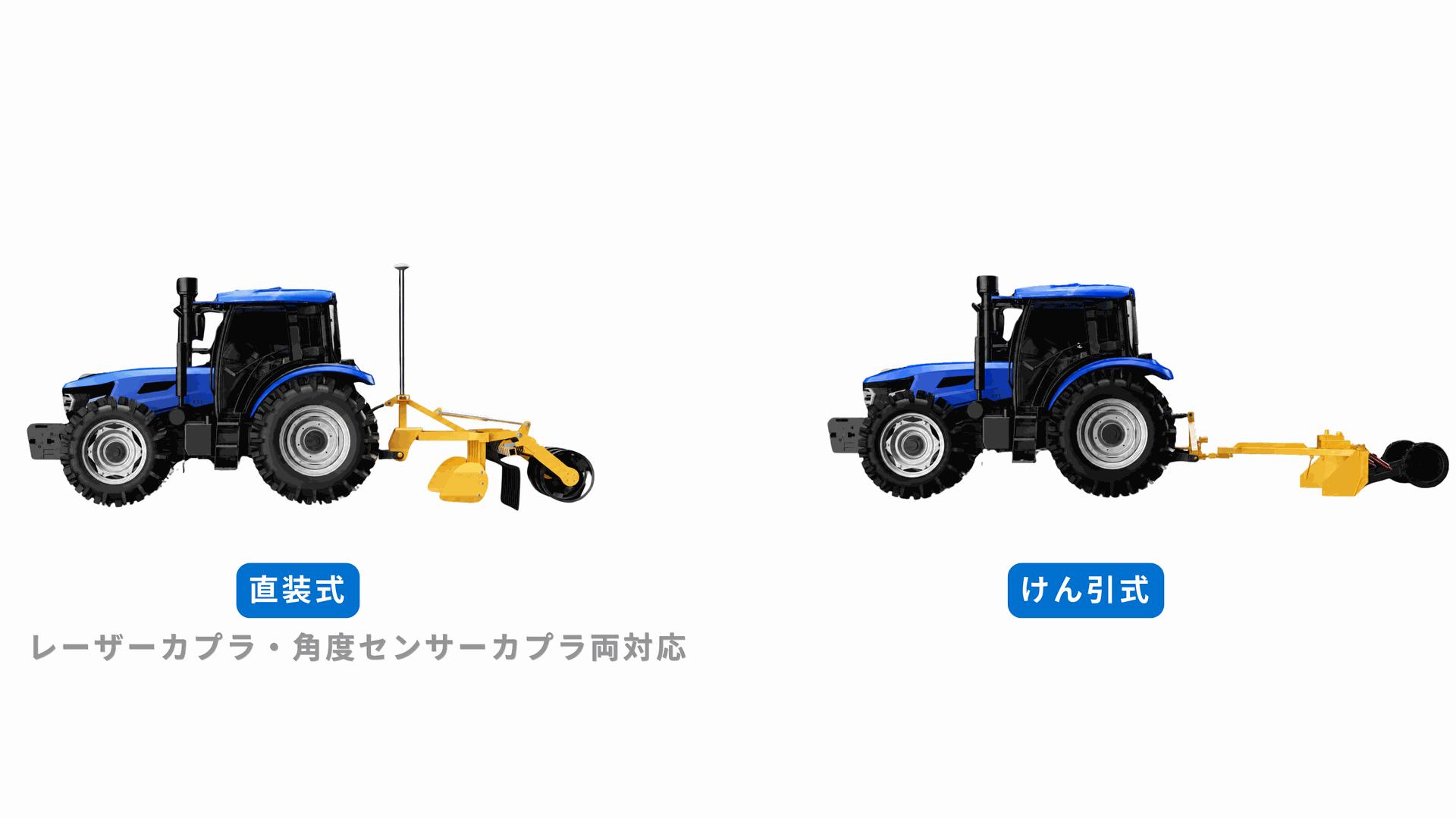
幅広い対応性
直装式・けん引式レベラーに対応。レーザーカプラ・角度センサーカプラの両方に接続可能で、幅広い機種に対応します。