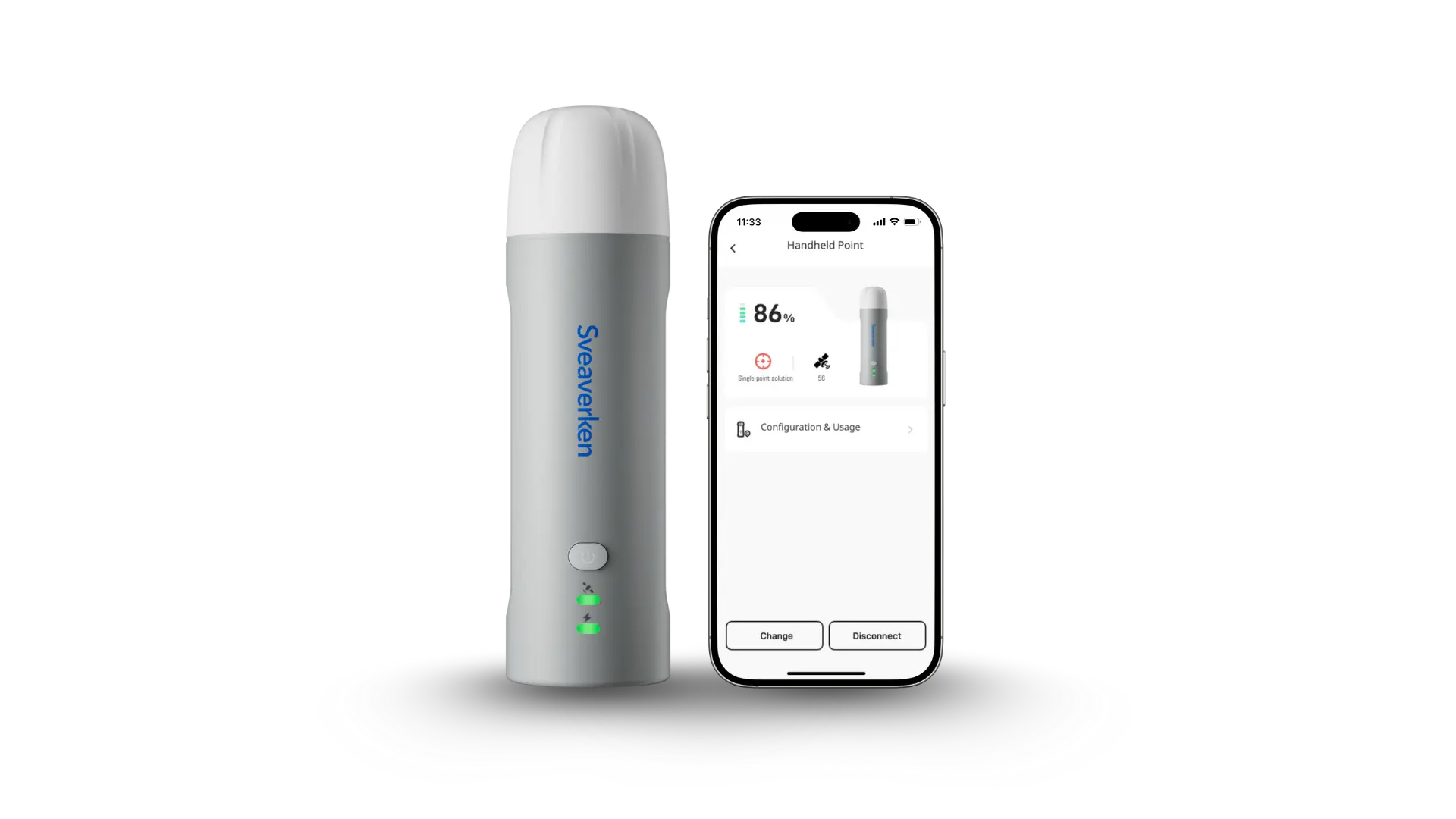
Sveaverken Pocket Mapper

Precision that fits in your hand
Pocket Mapper is a lightweight, weatherproof RTK device built for the field.
It fits in your hand, lasts through long days, and maps land with centimeter accuracy. From farms to barns to open pastures, it captures every boundary, facility, and field detail — helping you measure, plan, and work smarter without extra gear.

Pocket-Sized

Battery Life

Accuracy

Coverage

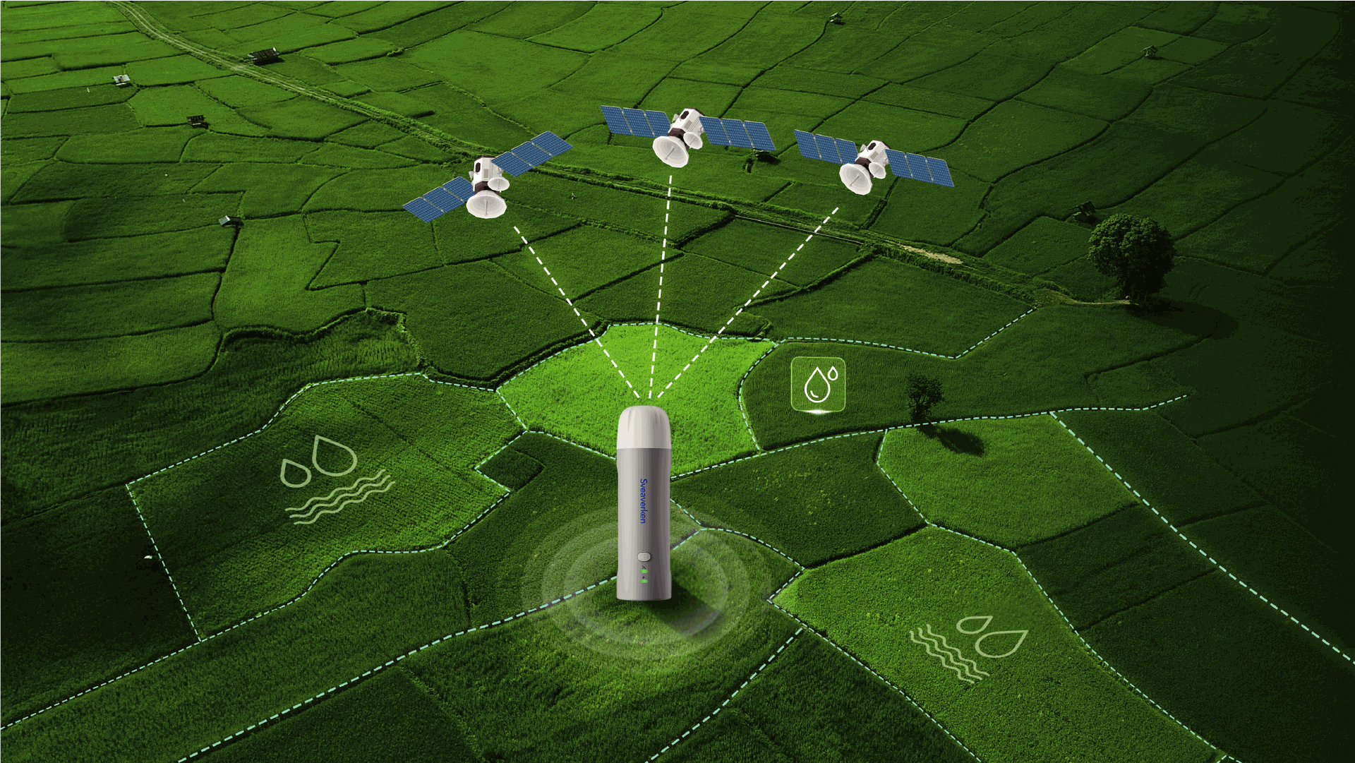
Mark your land down to the centimeter
Forget GPS guesswork. Sveaverken Pocket Mapper uses RTK positioning to deliver centimeter-level accuracy for every boundary, plot, and marker on your land. You can record irrigation lines, planting zones, and field borders with the precision needed for modern, data-driven agriculture.
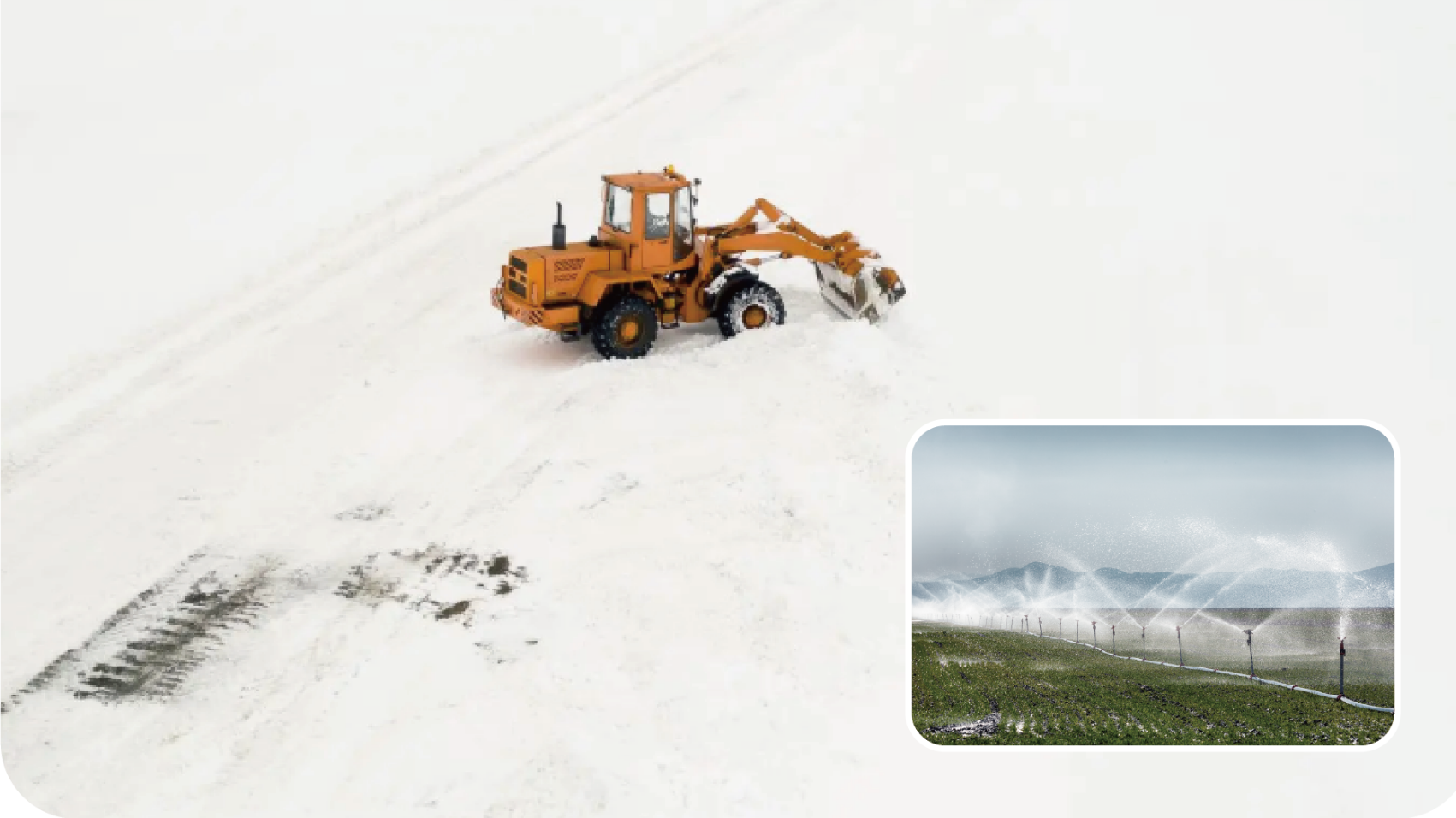
Know what’s under the snow
Finding buried water valves and pipes under snow can be time-consuming and expensive. With Sveaverken Pocket Mapper, you can record their exact positions before winter arrives. This keeps your infrastructure mapped and easy to find all year, saving you time and preventing costly digging mistakes.
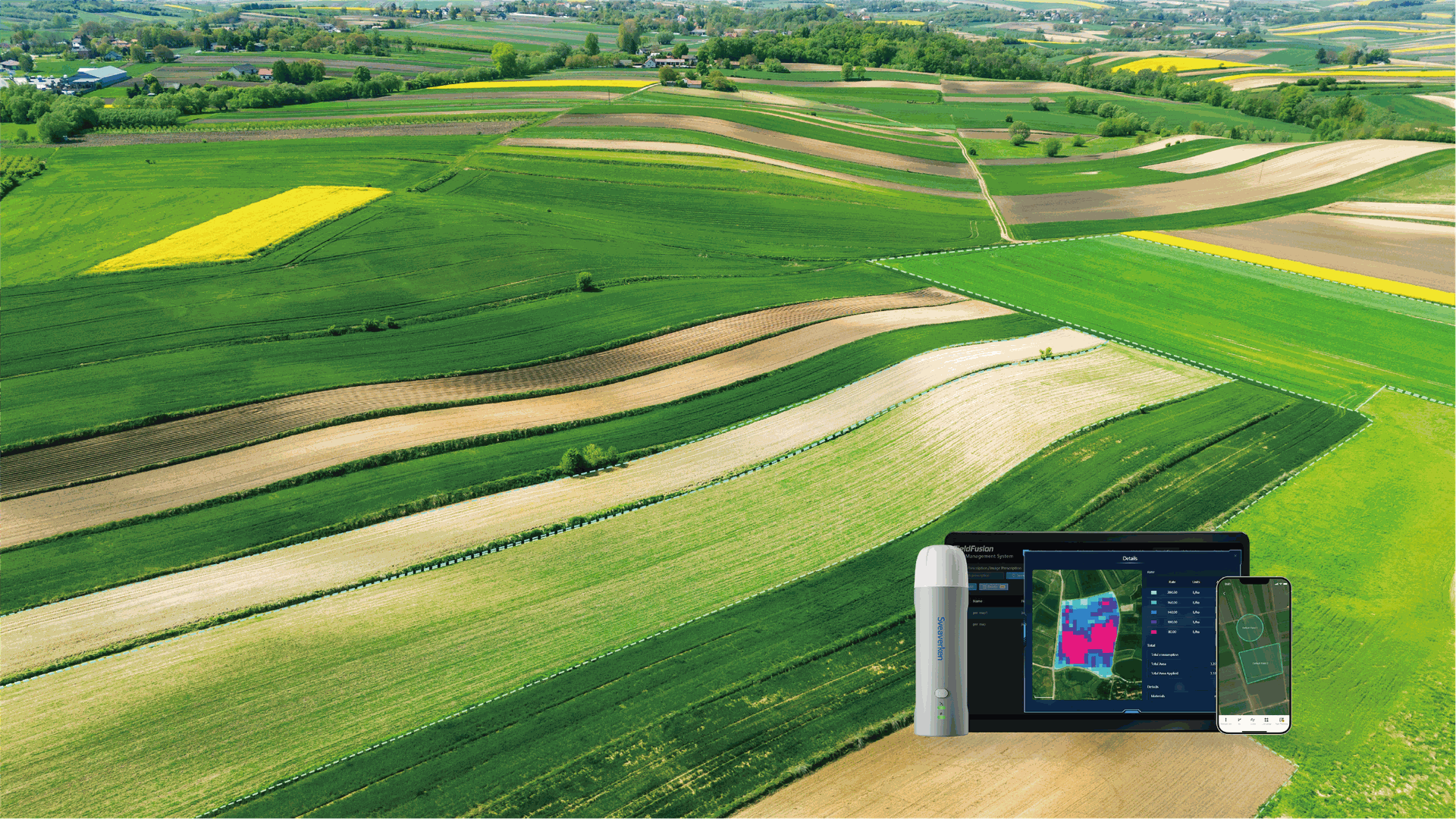
Define your land clearly
Sveaverken Pocket Mapper records field edges with centimeter accuracy. This verified history is stored in FieldFusion, making every boundary traceable and giving farmers complete confidence in their managed plots.
Map your fields the easy way
The first step to any smart farm? A clear map. Forget tractors or bulky gear—now, mapping just takes a walk. Use the Sveaverken Pocket Mapper to walk your field and create an accurate map in real time. This quick, hands-on process saves hours of setup time.
Sveaverken Pocket Mapper Plus
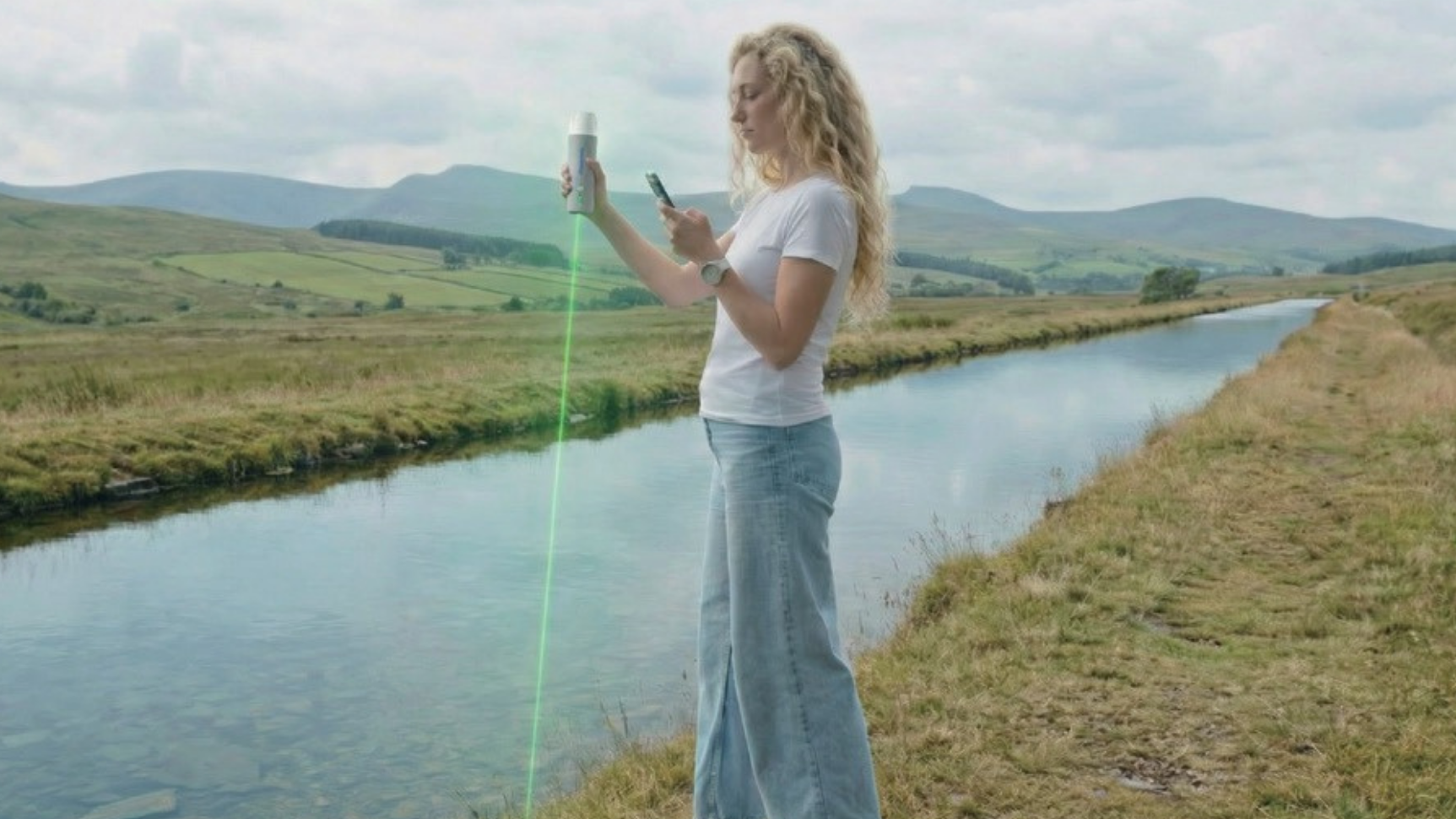
Reach every point with laser precision
Is your field surrounded by fences, ditches, or uneven ground? Sveaverken Pocket Mapper Plus uses laser measurement to capture points you can’t reach-from across a swamp, over a fences, or around obstacles. It turns complex terrain into clear, accurate maps without slowing you down.
Sveaverken Pocket Mapper 3D

Build a smarter barn, from ground to cloud
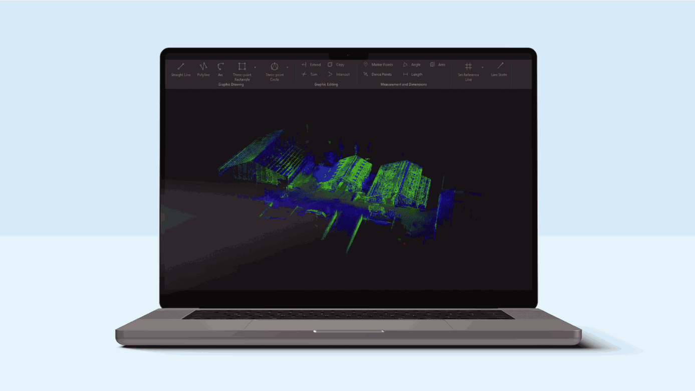
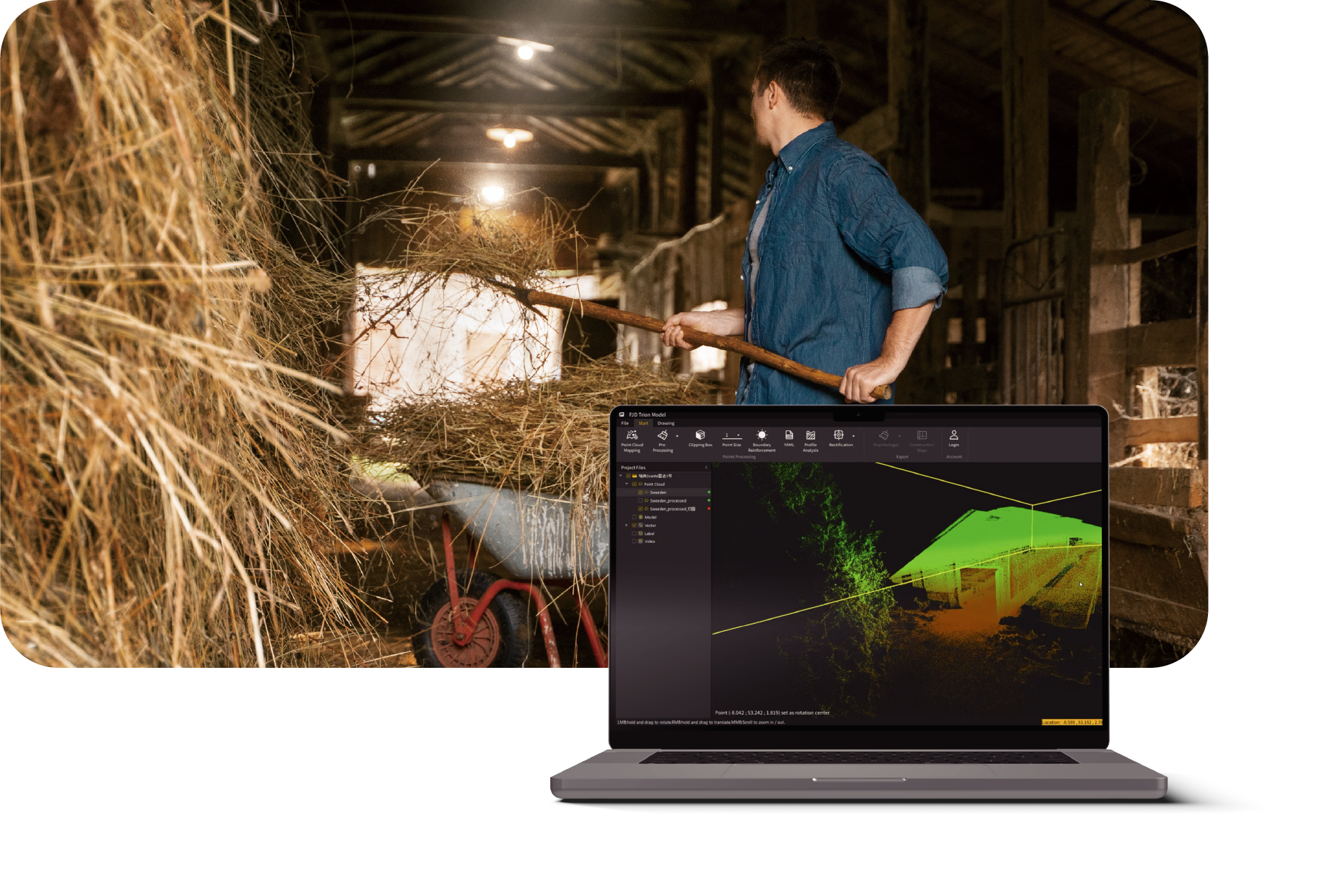
For fields with fences, ditches, or uneven ground, Sveaverken Pocket Mapper 3D captures points you can’t reach. Walk around to collect dense 3D point clouds and monitor progress in real time with the Scan App, ensuring full coverage and precise maps of complex terrain.
Regular scanning helps you plan construction adjustments, optimize cleaning and feeding routes, and reduce inspection time from days to hours—saving labor, materials, and stress. Your farm becomes easier to manage, safer to operate, and ready for automation.
From piles to precise numbers
Sveaverken Pocket Mapper 3D uses LiDAR to create detailed 3D models of barns, silos, and grain piles. Simply walk around the area, and the SveaMap software instantly provides precise 3D models and calculations of your space. Use this data to track storage, prevent losses, and plan your harvest with confidence.
Run Pocket Mapper via FieldFusion
Download Here

Specifications
Basic & Plus version
3D Version
0.1 ~ 25m (10% reflectivity)