In modern agriculture and surveying, even a tiny error can cost time, resources, and efficiency. Imagine guiding an auto-steering tractor, managing a large farm, or operating drones with centimeter-level accuracy—all without interruptions. The Sveaverken N10 CORS system delivers exactly that: stable, reliable, and highly accurate positioning across a wide range of industries, making complex tasks simpler and more efficient.
Your Reliable Partner for Precision Work
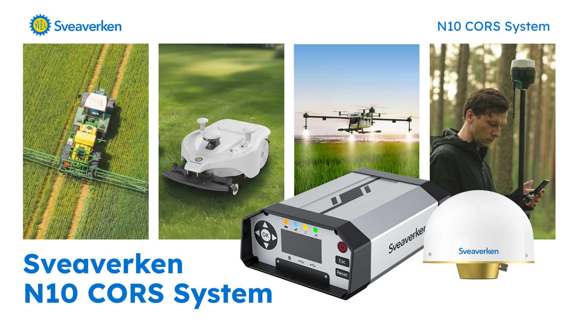
High-Precision Positioning
The N10 achieves ±2.5 cm rover accuracy across large areas, leveraging multi-constellation, multi-frequency GNSS and full VRS network support. Whether you’re mapping a large farm, guiding automated machinery, or performing drone operations, N10 ensures your work is consistently precise and reliable.
Stable Signals with Dual-Channel Broadcasting
Connectivity is critical for continuous RTK operations. N10’s dual-channel simultaneous broadcasting sends correction data through both the internet and radio. Users can easily switch between channels depending on connectivity, ensuring reliable positioning even in areas without network coverage. This ensures stable, uninterrupted positioning even in remote or signal-challenged areas, allowing you to focus on your work instead of troubleshooting connectivity.

Smart Connections and Backup
The N10 is designed with reliability in mind. It intelligently prioritizes connections in the order of Ethernet → 4G → Wi-Fi. If one connection drops, the system automatically switches to the next available option, ensuring the base station stays online at all times. This built-in redundancy guarantees continuous RTK corrections and reliable performance, even in tough environments.

Effortless Workflow with FLBS Platform
Managing high-precision positioning data can be complex, but the N10 simplifies the process. Combined with the FLBS platform, it handles everything from data collection to processing, allowing you to access, manage, and utilize your data seamlessly. This integrated workflow reduces errors, saves time, and makes high-precision positioning accessible even for teams without specialized expertise.

Automatic Data Management
All raw observation data is automatically uploaded to an FTP server, eliminating manual transfer steps. This not only saves time but also enables easy data analysis, sharing, and collaboration across teams or project sites, ensuring everyone stays on the same page.

Flexible Coordinate Options
Different projects have different requirements, and N10 adapts accordingly. It supports both geodetic and Cartesian coordinate systems, offering maximum compatibility and flexibility for a variety of tasks—from large-scale land surveys to localized machine guidance.

The Sveaverken N10 is more than just equipment—it’s a reliable partner that enhances efficiency, reduces errors, and ensures every task is done right. Real-time, accurate positioning helps you confidently complete projects of any scale, from precision agriculture and landscaping to surveying and mapping. Want to see how N10 can transform your operations?
Contact us today for a demo or consultation, and experience real-time, centimeter-level accuracy in your projects.